Continuing from our previous blog of
Kalavantin Durg....
 |
| The target |
Once we came back from the Kalavantin Peak and reached the base of the stairs, there was a very narrow trail towards the left, which according to the shopkeeper led to the Prabalgad Fort. The other way was to hike all the way down to the base camp and then trek back up again through the different route.
 |
| Cave in the hill |
So we set out target reaching to the Prabalgad Fort and follow the shortest possible way, even if it was a little riskier and harder.We decided to take the trail. Just few meters into the trail we came across a cave cut in the hill rock. It was perfect square cave.
 |
| Trail start to Prabalgad |
We were not sure that if it contained any harmful creatures or insects and hence explored only few meters into the cave and then came back. We also abandoned the cave exploration as we did not have a torch with us. We kept moving on the trail and there was another group also which was moving behind us. The trail was risky as when we looked up we could see the hill side above us. Also, there were a lot of bees and hornets in the rocks. So beware of them. If possible do not use strong perfumes or deodorants as it attracts them.
 |
| Trail with fallen rocks |
Also the trail was littered with broken rocks due to natural causes. At some places there were big rocks, which had fallen down and made sort of tunnel. That was fun. In one such tunnels there was not enough space for us to go through so we have to navigate around. Once again, the drop from the trail was not that deep but it would seriously injure if someone slipped and fell down the hill. Finally after hiking for about 20 minutes we came across a dried up waterfall end. There was a lemonade shop again. Since we were extremely thirsty, we had lemonade and then we started our way up the waterfall stones/ rocks as that was the fastest way to the Prabalgad plateau. I would say, climbing those big stones, stretched our legs to extremes.
 |
| The beautiful flower |
Most of the rocks were huge bricks from fallen fort walls. We could easily identify them from the perfect cuboid shapes. We came across a lot of wild fruits and flowers. One such flower was extremely beautiful (purple in color, blooming in spherical bunches). We have never seen that flower and were mesmerized by its beauty. We clicked lots of pics of that flower and then moved forward.
 |
| The sign board |
After hiking for almost 30 minutes we came across an area where we could see some structure ruins and also a gate arch buried in dirt and soil. We moved ahead and then after another 25 minutes of hiking we came across a flat area which had a sign post, with something written in Marathi. We only understood one thing that fort was on right and something was on left.
 |
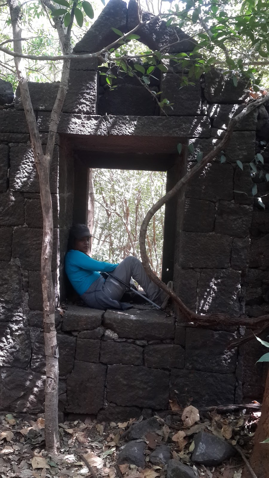
| Structure ruins |
There was a group of trekkers who said that there was nothing on right, but we still decided to explore ourselves. After moving around hundred meters on the jungle trail we came across a roofless structure with couple of windows. We hopped inside it and could see wild flora and fauna growing uninhibited. We rested there for around 10 minutes. It was extremely peaceful and serene in that jungle with no sound but chirping of birds.
 |
| Trail of leaves in jungle |
So far we had followed a narrow trail of broken leaves. The trail was no more than 1.5 feet wide. We could also see some markers on stones and trees left either by the previous trekkers or the villages. We kept following the markers and in between we saw many similar structures.
 |
| Temple in jungle |
Finally we came across a small temple from where the trail divided into two. We deliberated for some time which one to take and decided to go on left which ended in a sort of dead end and so we came back and to the right path thinking that it would take us to the village again. It was a little confusing as every now and then we could see arrows in both the directions. So, we decided to keep following our original direction.
 |
| Ant hill in jungle |
Basically we were crossing a big jungle on top of the plateau. We came across various open areas, a dried up pond, bamboo jungles, large wild grass area, etc. After walking for almost 40 minutes we came across 4 trekkers who were coming back from opposite direction. We asked them if there was any way to get back to village by the trail we were following. They replied in negative and said that there was a scenic point at the end of the trail.
 |
| Clearing in the jungle |
So, we kept moving and moving and moving. We went under and over the fallen trees, saw a lot of big ant hills. enjoyed the jungle, kept getting tired and tired and depleted our water supply completely but finally we came across a clearing. At one point I wanted to turn back but my crazy partner said, we should keep going, as we had already come so far. The view as we went ahead was worth every step we had taken so far.
 |
| Scenic view |
It was an awesome natural beauty that we saw at the end. We were basically at one end of the plateau and there was no way ahead from that point. We did some photography. Also if anyone wants to do a night camping there, it can be done as there is a good enough area to do so, and judging by the litter in the area we could easily see that people had camped there. We spent some time there and then took our way back.
 |
| Camping area at plateau end |
We kept drinking artificial fruit juice to keep the energy levels up, as by now were running on will power only. On the way back we came across a group of trekkers who were sitting down and almost decided to go back, but we assured them that the view at the end was worth it and they should go and see it. We got lost once on the way back, but we backtracked and got back on trail again. it took us almost two hours from sign board to the scenic view point and back to sign board.
 |
| Kalavantin Durg from Prabalgad |
Finally we reached the sign board again and were about to go back down through the water fall again but a couple of guys told us that we should visit the other end also as it provided a good view of the Kalavantin Durg, which you find when you search online. So we started our hike again towards the other end of the trail. The route was almost flat like the other end of the plateau and it took us almost 25 minutes to reach to the other end of the Prabalgad Plateau. The view of Kalavantin is unparalleled from that spot and we finally understood that the pics we see on google search are from this point actually.
 |
| Jungle trail |
It was very hot so we only spent 5 minutes there and went back again to the sign board. From there it was the hard waterfall trail again to go down till the lemonade shop which we were praying to be open as we had by now exhausted all our liquid supply. To our disappointment, the shop was closed when we reach the base of the waterfall. It took us around 30-45 minutes to get down. We took very small breaks in between to catch our breath. from that point we had two choices - either follow the same narrow trail we took from the Kalavantin steps base or follow several other trails, going into the village, which we can see from our spot at that height. Finally we decided to explore a new route and started following the trail just few meters to the right of the waterfall base.
 |
| View from plateau |
The initial climb down for around 100 meters was a little steep but after that it became gradual climb down. We found another lemonade shop 15 minutes into the climb down. We were so happy and had a lemonade and purchased water. Then we started to get down to the village. We were glad we chose this route as this was way flatter than the way we took to climb up to the Kalavantin from the village. Eventually after 25 minutes we reached the Base camp and decided to rest at the restaurant. We ate a thali meal at the restaurant and then set to descend the remaining distance to the parking lot.
This was challenging, as by now we had no energy left and out feet were moving on auto mode. We kept walking and also took one shortcut to reduce our distance. It took us another 30 minutes to reach to the parking spot where we once again had to purchase water due to the high heat. Then we took our bike and left for Powai. It took us almost 2.5 hours to reach Powai.
Overall it was very enjoyable trek. The jungle walk was awesome, getting lost was fun and exploring the less used trails was thrilling. Few points if you are planning to take up this trek:
- Carry at least 3 liters water per person if you are doing in rainy season and 4 later water per person if in summers. Its not the climb that exhausts you, its the sheer distance that you will need to walk, that will exhaust you
- Do visit both ends of the plateau as both offer unparalleled views
- Good to have trekking pole
- Trekking shoes are must for this trek
- Do carry liquid eatables, especially rich in sugar/ fructose. It will help you keep energised
 |
| Panaroma View |
Till next time.. Bye Bye...
Hill-Skippers
hill.skippers@gmail.com
P.S. Do not litter. Keep nature clean.


Comments
Post a Comment